EXAMPLE: Nansenbushū bankoku shōka no zu
Item
-
Title
-
EXAMPLE: Nansenbushū bankoku shōka no zu
-
Alternative Title
-
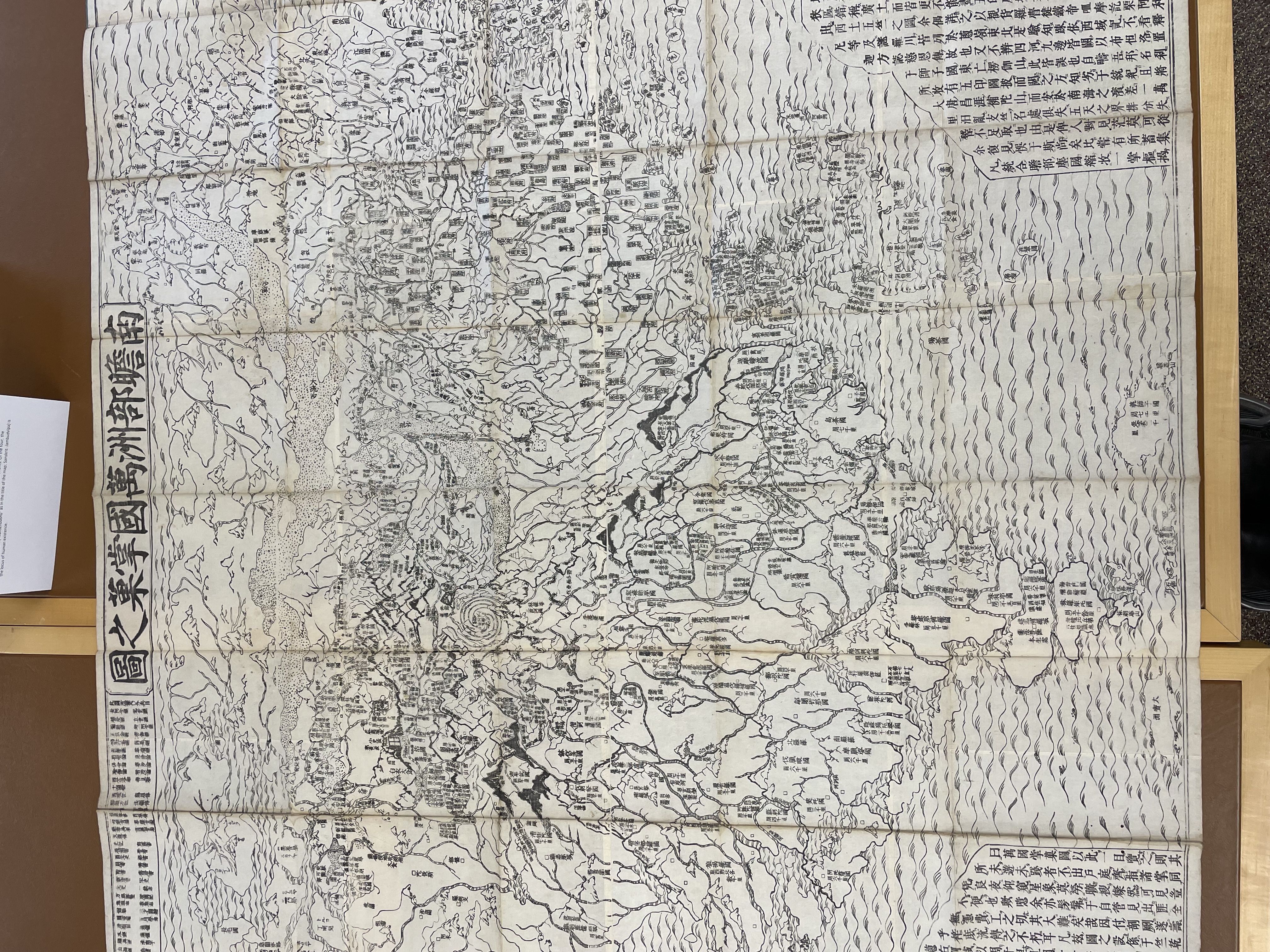
南瞻部洲万国掌菓之図
-
Description
-
First edition of one of the earliest Japanese printed maps depicting the world. Created by the scholar monk of the Kegon school, Hōtan (1659–1738), the map describes the traditional Buddhist worldview, but also including Europe represented as a group of islands (Iceland, England, Holland, Scandinavia, Poland, Hungary, and Turkey) and South America (shown as an island just south of Japan in the lower right). At the center of the Buddhist cosmos is Mt. Sumeru, surrounded by four continents. Of the four, the Southern continent (“Nansenbushū” as in the title of the map; Sanskrit: Jambudvīpa) is the locus of human existence.
-
Creator/agency who created the original map
-
Hōtan
-
Date
-
1710
-
Contributor
-
Cynthia Leng
 Sample 1